
The Armenian government, in response to Azerbaijan’s demand for border adjustments, agreed to cede some territory around the village of Kirants to Azerbaijan. Subsequently a comment from an individual minimizing the cultural value of any local sites was quoted in the press. I am unable to retrieve the exact quotation or its source.
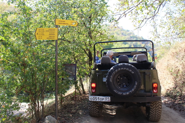
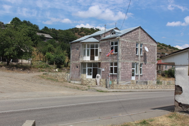
Kirants village is located in northeastern Armenia close to the Azerbaijan border. Originally named Getashen, in 1967 the village was named after the Kirants monastery. Kirants village is about a 2 ½ hour drive from Yerevan over good roads.Nearby in the forested mountains are monasteries and defensive structures that, according to many sources, have not been adequately studied. Maps show a tertiary road accessing some of these sites from Kirants village. Though some on-line sources indicate a car can negotiate this road, we were advised by villagers that our rented Niva, a sturdy 4WD Russian off-road vehicle, could not. The road runs from Kirants village towards the SW, through a very damp forested hillside along the northern bank of the Karahan river (the river has multiple names). Having traveled this road on a number of occasions with experienced drivers, with vehicles similar to or clones of WWII Jeeps (called Willies), we barely made it through the deep, mud filled potholes. One driver of a 1942 Jeep clone predicted that in another two years the road would be impassable. Ironically, clearly written signs in English and Armenian posted along this road direct the traveler to the major sites in this area.
The last visit was in the summer of 2023 during a very hot, dry spell, believing that the road to these sites would be dry, and the potholes not filled with mud. Though access to these sites probably would not have been feasible during previous years, access to Samsoni and Deghdzniti Vanks still presented challenges to our highly skilled driver Rudik. When asked if we could get to Mahkanaberd, a fortress in the area, he declined, adding that he may cease taking visitors to these sites as it takes a lot of gasoline to navigate the obstacles, and maintenance of his customized souped-up jeep type vehicle is costly.
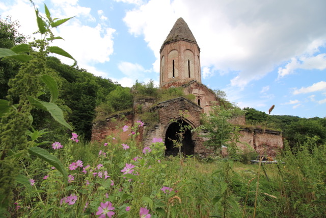
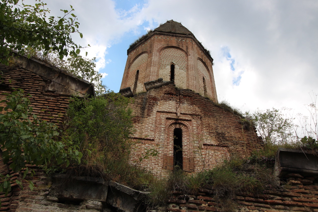
Kirants Monastery (Կիրանց Վանք) is about 13 km west of Kirants village, though this is no easy 13 km. The monastery dates to the 13th c and includes two gavits, a dining hall, two other churches, a cemetary, living quarters and the infrastructure necessary to support a monastic community. Much of this is now in ruins or overgrown with vegetation. Kirants’ architectural style derived from early medieval domed basilicas such as Odzun, Gayane, and others. Unlike most other churches in Armenia, however, this church is constructed of fired brick and plaster rather than the traditional tuffa stone. Colored tiles face the outside of the church while the inside is, or was, covered with murals and frescos, now mostly faded. Because the Byzantines and Georgians had significant influence in this region, the church was originally constructed as an Armenian Chalcedonian church. About a century later, as this influence weakened, the monastery reverted to the Armenian Apostolic church. The drum upon which the dome rests is hexagonical on the outside but cylindrical on the inside
Legend has it that the church was constructed by a young mason who wished to impress his master, the wealthy father of a young woman he was interested in . When completed, the master was invited to critique the mason’s work. He could find no fault; all he could criticize was that the mason used “too much lime“ (kir antskatsnel – Կիր Անցկատցնել). Hence the name “Kirants”.
Srvegh, a church with similar construction near Aygehovit village in Tavush marz, was built around the same time. Kirants’ architecture in general had a large effect on subsequent church construction.
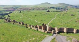
Arakelots Monastery (Առաքելոց վանք -Monastery of the Apostles) is about 3 km from the village of Kirants, along the same road leading to Kirants Monastery. Surrounded by vegetation, the monastery is not clearly visible from the road. Climbing over a slight rise, a tall fortification wall becomes immediately visible. The church was constructed in the 13th c though some sources cite the 12-13th c. Historically this area contained a number of settlements, a small church, a chapel, a caravansary and other structures. The second church of the complex was built in the 14th c. This was a highly traveled region with trade routes passing through.
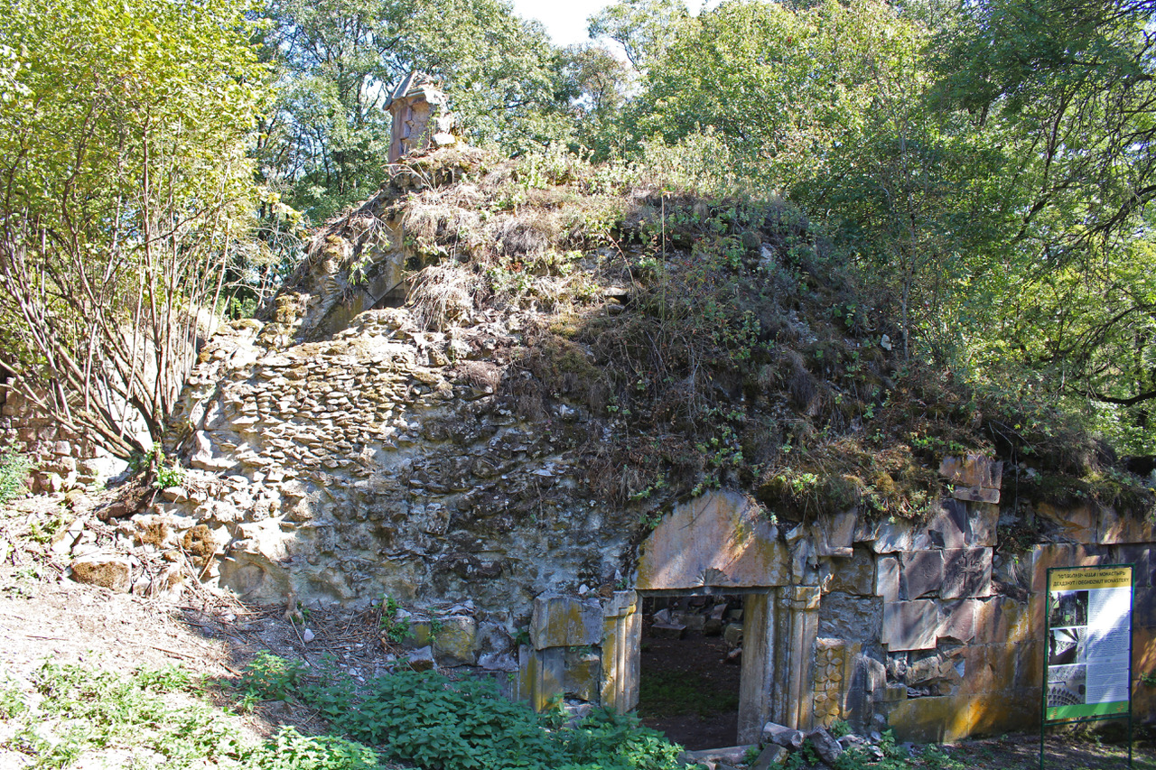
Deghdznuti Vank (Դեղձնուտի վանք) construction started in 1258 and was completed in 1274 by Archimandrite Arakel from Tarson city in Cilicia. There are two churches, and a gavit where Archimandrite Arakel’s tombstone lies. The Gavit’s dome is supported by intersecting arches, a common architectural construct. The church had intricate stone carvings, including remnants of khachkars carved by master stonemasons Petros and Kahak (1274). Deghdznut is considered an exemplary example of Armenian medieval architecture. The name “Deghdznoot” may refer to “peach” (deghdz -դեղձ) as peach orchards abounded in this area.
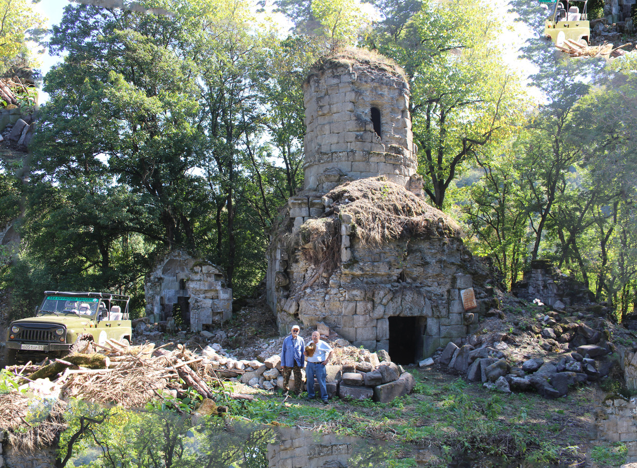
Samsoni Vank (Սամսոնավանք) is 6 km beyond Deghdznuti vank, though sources indicate this site may be more accessible via the village of Yenokavan, which is in the hills adjacent to Ijevan. Remains consist of a highly eroded domed church, a shrine, plus another small church. The Berdakar medieval fortress is supposedly nearby.
[1] References: There is not a lot of detailed information available about most of these places. Much of the information here was gained either verbally or from internet sources, which were often contradictory or simply replicated information from other sites. A number of articles indicated that these sites have not been adequately researched. An easily acquired reference to sites in the Republic of Armenia, and Artsakh, is “Rediscovering Armenia” by Brady Kiesling and Raffi Kojian. It is available both as a softcover book and on-line.